Posts

Image
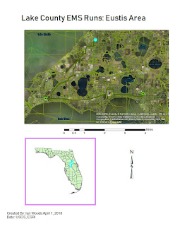
Geocoding in the heart of Central Florida: EMS route round ups This weeks lab was pretty fun! I had a blast geocoding addresses of the various Fire/EMS stations in Lake County, FL. What I found odd about the process is the matching addresses part. It was strange that several of the addresses listed in the database were matched to street/highway locations which were in the middle of nowhere.  What I found fun about the Geocoding part for searaching for the locations on Google Maps and Bing Maps. It's funny that Google maps had some completely different street numbers on the same roads that Bing Maps had. I much prefer the graphics and layout of Google Maps! It's also cool that we can essentially tailor create our driving routes. We can choose  which way is the fastest route or one that gets location drop offs in the most inconvenient locations first, so that the easy ones (the best) can wait for last. Overall I really enjoyed this lab! There's plenty more to learn ab...
Image
Finding the right campsites under all those vector overlays During Week 10 of the course, I got to work with data of a somewhat discreet origin and in a complicated matter. We were basically to separate waterways, roadways, and land conservation areas to pinpoint where to right place was to plot down a tent.  This was an interesting lab where we got to use quite a bit more tools in Arc Map, namely Python. Python allowed me to enter in lines of code to filter out data not needed form that which was needed to analyze the geographical area.  It really was fun, but it had some challenging moments. I would say that I have learned a lot still about the features and tools in ArcMap. I do however look forward to continue learning more. I am one those people that will have go back over what we have already learned in the modules in spare time, if nothing more just for a refresher. ArcMap is really cool! I especially liked in this lesson how you can create varying buffers, an...

Albertsons Grocer's time in Pensacola: A change in one former store's polygon shape

Image
This post doesn't relate 100% to my course in GIS, but since this relates to Pensacola and a grocery chain which used to have a strong presence there, I thought why not? Actually there was a slight change in the property of one former Albertsons store location in Pensacola on Mobile Highway. I like going to the grocery store, and I really like Publix. They have awesomely well run and clean stores and lots of bogo sales! However I have good memories of shopping and renting movies at one particular grocery chain back in the day, and that was Albertsons. I also used to like Winn-Dixie as a child, but as time has gone on, their stores are not nearly as nice and clean as they used to be, nor do they have the great deals. Enough about my experiences though. Let me get right into the meat of what this post is really about: Albertsons past stores in Pensacola and their associated properties. To start off, let me explain that a lot of information I have is from another blog I discovered...

Marion County Florida's Wetlands and Public Land Areas

Image
During the past week and a half, I have had the opportunity to work on a very fun lab! We had the opportunity to look up data ourselves, rather than having it provided to us. It was really cool going into the Florida Geographic Data Library to pick out several pieces of data that I needed for my map(s). Also, we utilized Labins.org for our DEMs and DOQQ's. In my case, Marion County was the subject of study. Marion County just happens to be one of (if not the largest) county in Florida (land area-wise). Obviously Monroe County in the Keys covers a larger area, but that county is mostly encompassed by water. Marion County's County seat is the city of Ocala. The raster data set showing wetlands (which I labeled "landcover") shows that the western half of Marion County is largely woodland with an elevation of around 71 feet or so. As you move over to the east of Ocala, the landscape gets lower, more marshy, and generally wetlands. What's especially interesting to ...

Projections Part II

Image
In this week's lab, we learned how to access and download data from two sites, labins.org. and fgdl.org (Florida Geographic Data Library). We were able to download, define, and project the data onto a blank ArcMap. For the most part it was pretty easy finding the data, but ensuring the the data was projecting in the correct location on the map, was a bit of a challenge. Here are the results of my work: I was able to project a quad (4 aerial images) of southwestern Escambia County on my ArcMap along with the County Boundaries layer. Also, major roads are mapped in the area. The only problem was being able to correctly place on the map the locations of storage tank contamination sites. After trying again and again to project the data in the NAD 1983 (2011) State Plane Florida North FIPPS 0903 coordinate system, it just wouldn't work for me. I'll have to go back and review the lessons again, to see what I did wrong.

Projections: The variance of discrepancies among three coordinate systems

Image
I want to start off by saying this was a fun lab! I'm starting to get the hang of ArcMap much better! To make things better, my work schedule has been fine tuned and I am geared up and ready to do seriously better with map making and in this course overall. What we have below are three individual maps from three different projection coordinate sytems: the UTM, State Plane, and Albers. Upon application of data derived from various datasets for Florida's 67 counties, we created 3 separate maps. From the look of my maps, you really can't see much of a discernible difference. However, once we pulled up the raw data we discovered a different story! When we dove in further to pull up data for Alachua, Escambia, Miami-Dade, and Polk counties, we discovered that each projection yielded greatly different amounts of land area, especially as you get down to Miami-Dade County. I learned from this lab that in the future when I want to make and analyses of Map projections, all systems ...
Image
Well, This has been a rough week for me again! This is certainly not going to be my best upload, but here I go. I thought I would follow along the same route as proposed in the course with regards to information given on my map. In the class example we were given the Top 10 Redneck Cities in Florida taken from the website "Road Snacks". I decided to share a map showing the Top 10 Hippie Cities in Florida. To my surprise, Road Snacks had also done research for which cites in Florida had the most hippies. Even more surprising, all of the cities are clustered tightly together in Southeast Florida! I would thought that the major college towns of Tallahassee and Gainesville would have been included, but they weren't. Anyway, here is my crude map of the Top 10 Hippie Cities in Florida. Yeah, I'm frustrated the things went in this lab. I have had issues with my work schedule this past couple of weeks, and am getting things sorted out. Those issues have lead me to getting s...